
 |
 |
 |
 |
 |
 |
 |
 |
 |
 |
 |
 |
 |
 |
 |
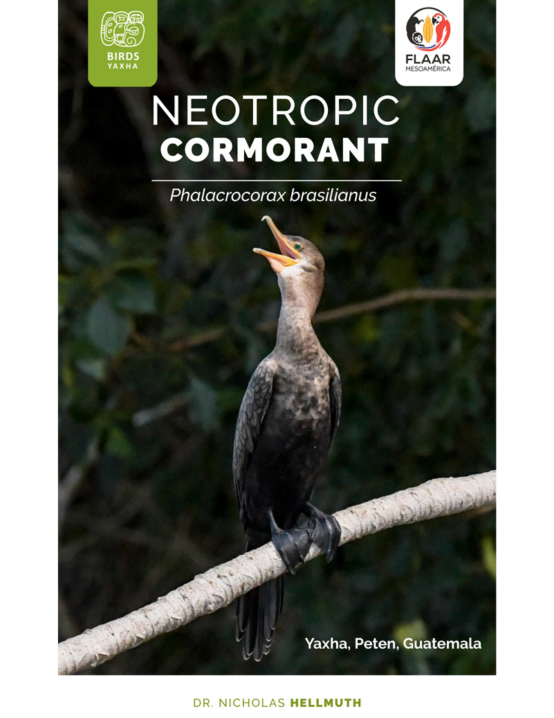
Reports by FLAAR Mesoamerica
on Flora & Fauna of Parque Nacional Yaxha Nakum Naranjo
Peten, Guatemala, Central America
Two new FLAAR Reports on Yaxha, PNYNN, RBM, Peten, Guatemala plus views of a rarely published Maya bedrock sculpture at another Maya site
Posted July 27, 2026
by Nicholas Hellmuth
We have posted a mention of a “rarely before discussed” Classic Maya causeway that we found at Yaxha that leaves the north part of Yaxha and heads far away. In 1970’s the FLAAR team found this causeway but now that LiDAR is available via PACUNAM to other projects, we hope to inspire them to show the entire sacbe and to what site north/northeast of Yaxha that this unnamed calzada heads to. I would suggest calling it “Inter-site Yaxha-(name of the end) Sacbe”.
We are also posting this week more photos of the remarkable Yaxha bedrock outcrop that the local Peten assistants found in 1970 and we published in 1993—but now we have found more photos. And Paul Graf has more modern photos soon to be available, so we wanted to make all our photos available.
 |
 |
|
Even more remarkable is a bedrock outcrop sculpture that Hellmuth photographed in the 1970’s-1990’s that we have not yet found published elsewhere. But since this bedrock outcrop has such well-preserved Classic Maya portraits surely other archaeologists have published it. We would welcome a PDF of such publication(s) so we can create a bibliography. We estimate this was in Campeche or nearby Maya areas. |
|
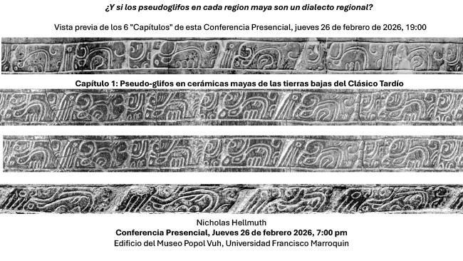
Six Chapters of Regional Styles of Classic Maya Pseudo-Hieroglyphs
Posted February 20, 2026
by Nicholas Hellmuth
 |
|
Although the presentation will be in Spanish, all six chapters will also be available as downloads in English after the lecture date. This presentation has hundreds of rollouts of Maya vases, several of which are high-resolution digital rollouts by Nicholas Hellmuth that have never been published before. So download the Preview now, and then return to this site to download all six chapters during the first week of March. Although the lecture topic is Maya hieroglyphic writing, all the hieroglyphs are on vases, bowls and plates that show lots of mythical symbols, scenes of the Maya people—so, LOTS more than just hieroglyphs. Pseudo-Glyphs deserve a new PhD dissertation by a student who would like to make breakthroughs in epigraphy—since 90% of research on glyphs on vases, bowls and plates have understandably focused on the PSS (Primary Standard Sequence dedicatory formula). But there are hundreds and hundreds of Late Classic bowls, vases and plates (plus Terminal Classic, Tepeu 3, mold-impressed and carved bowls also with Pseudo-Glyphs). |
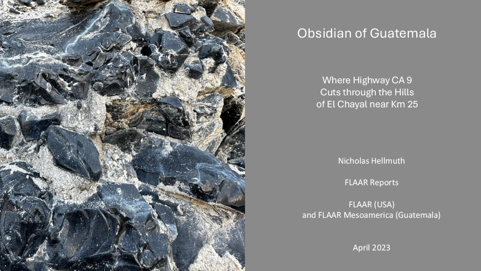
Obsidian was available to the Classic Maya in Black, Gray, and Mahogany Colors
Posted Octuber 27, 2025
by Nicholas Hellmuth
The Classic Maya of Guatemala did not have metal for tools or weapons, so the ancient Maya mined and worked obsidian to make tools, weapons, and jewelry. Obsidian carved in the shape of the moon and planets and constellations were placed under stelae in Peten and surrounding areas. Chert (also called flint) eccentrics were also used in stelae caches.
The Classic Maya also imported green obsidian via Teotihuacan trade routes, but that obsidian from Pachuca area of Mexico is very rare at Maya sites of Guatemala.
Obsidian is “volcanic glass” and thus found in many volcanic areas of Guatemala. The obsidian source closest to Guatemala City and easily accessible by highway CA 9 is El Chayal.
 |
|
This FLAAR Report is from our 2023 visit in March to study the different colors of obsidian easily visible where the highway cuts through one of the hills of El Chayal. |
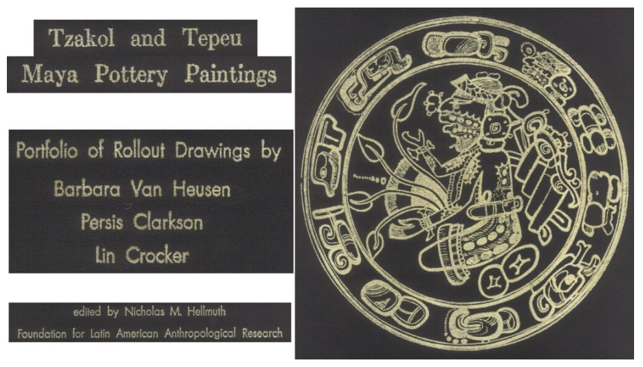
Drawings of Late Classic Maya Plates and Rollout Drawings of Maya Vases
Posted August 29, 2025
by Nicholas Hellmuth
In 1976 about fifty rollout line drawings of Maya vases and several drawings of Maya plates were issued as a printed portfolio. I estimate that only between 50 and 100 were printed. These are in libraries at major universities around the world.
But in today’s digital world, you don’t have to waste time going to a library to search for a book—you can download the book, article, thesis or dissertation on-line.
So our goal at FLAAR is to make available all the 1960’s, 1970’s, 1980’s, 1990’s publications in PDF format and available at no cost—plus you do not have to register—just download.
The original portfolio had about 56 drawings at double-page width—so the drawings could be at a healthy horizontal rollout format. Since the original edition was loose individual sheets in a portfolio envelope, most libraries lost several pages over decades. We also are missing Figures 6, 7, 15, 39, 45, 46, 47 and 49. We would greatly appreciate it if your university or museum library has these pages in the original portfolio so you can kindly send us a nice scan of as many of the missing pages that you can find. We would like to issue a year 2025 update with more documentation for each scene—but need to have all the missing images.
 |
FLAAR publications on monumental Maya architecture All three regional styles (Puuc, Chenes and Rio Bec) at one site: Santa Rosa Xtampak, Campeche, Mexico
Posted August 29, 2025
by Nicholas Hellmuth
Maya temples, palaces, acropolises and ballcourts were my research focus starting in 1961, when, at age 16, I went from my Spanish language school in Saltillo, Mexico (north of Monterrey) all the way to Palenque, Chiapas, in 3rd class buses. I stayed several days at Palenque, using a Leica camera that my father had loaned me. I took photos of the Classic Maya architecture but also the rain forest surrounding the ruins. I went back to Saltillo and then drove back to St Louis where I did my high school theses on Maya architecture. Since not many high school students write their thesis on Classic Maya architecture, my thesis won 1st prize in my class. This helped me get accepted to study architectural sciences at Harvard because I was not at the top of my class—universities also want people who do atypical projects. Then a year or so later I was kindly accepted by an INAH team what I met in Tabasco to help them carry their equipment and baggage the many kilometers to Bonampak, and I also offered to help them set up their camp. No airstrip at Bonampak in the early 1960’s, so your Cessna landed at a Lacandon village far away.
Then the Tikal Project asked me to help them as an architectural recorder and photographer at Tikal for an entire year of 1965, so again, my focus was on Maya architecture an entire year. During the 1960’s I also visited lots of Puuc ruins and in the 1970’s and 1980’s lots of Chenes and Rio Bec ruins. So when I learned that Santa Rosa Xtampak had a palace with a Chenes monster mask and also Rio Bec towers I coordinated with William Folan and the INAH team in Campeche to have a permit to accomplish photographic documentation of Santa Rosa Xtampak. While there in 1989 we noticed and documented Puuc architectural features in addition to the Chenes and Rio Bec aspects.
We have dedicated lots of time and effort to scan all our 1989 reports and wish to make them all available to INAH of Mexico and to archaeologists and students around the world.
 |
 |
 |
|
|
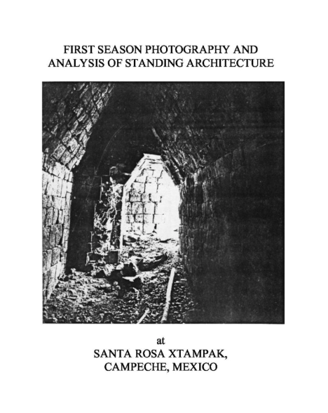
First Season Photography and Analysis of Standing Architecture at Santa Rosa Xtampak, Campeche, Mexico. Vol. I
|
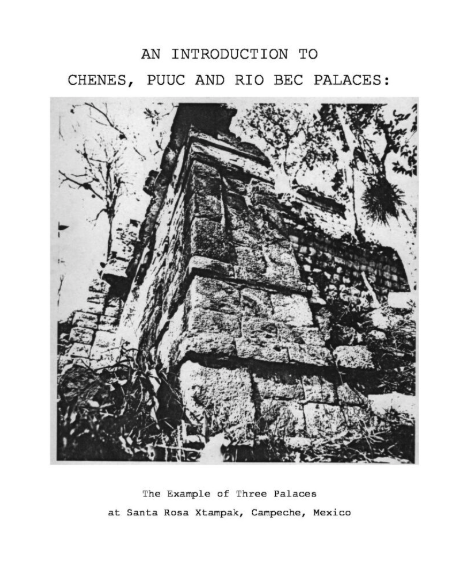
An Introduction to Chenes, Puuc and Rio Bec Palaces: the Example of Three Palaces at Santa Rosa Xtampak, Campeche. Mexico. Vol. II
|
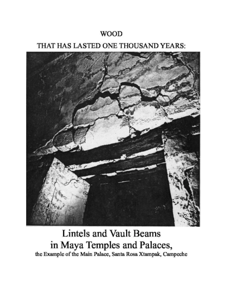
Wood that has Lasted one Thousand Years: Lintels and Vault Beams in Maya Temples and Palaces, the Example of the Main Palace, Santa Rosa Xtampak, Campeche. Vol. III
|
 |
 |
|
|
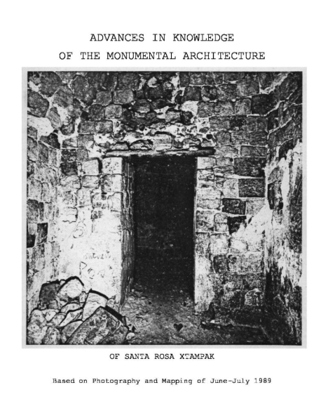
Advances in Knowledge of the Monumental Architecture of Santa Rosa Xtampak
Based on Photography and Mapping of June-July 1989
|
Notes on ROOM-#5-SUITE of the South-East Quadrangle
of the ruins at Santa Rosa Xtampak, Campeche, Mexico
by Jack Sulak, 1992
|
Medium Format Hasselblad Photographs
of Santa Rosa Xtampak, Campeche, Mexico 1989, by FLAAR
Contact Sheet Series 449941, Roll 08
|
We have been unable to find the helpful publication of Eldon Leiter, 1989, Inventory of the Lintels of the Main Palace at Santa Rosa Xtampak. If anyone in Campeche has a copy, a PDF would be appreciated.
Lots of capable 3D digital documentation of the main palace are by Erwin Heine, also from Graz. All his work cites his team; all their publications are in the bibliography of the remarkable 3D reconstruction of the main palace by architect and architectural historian Hasso Hohmann, also from Graz. FLAAR was headquartered in Graz before, during, and after Hellmuth’s 1986 PhD dissertation, but also simultaneously in 1989 as a guest visiting research professor at Rollins College, Florida. Hellmuth was also simultaneously a Guest Visiting Research Fellow at Yale University for multiple appointments, including 1989.
- 2017
- The Maya Temple-Palace of Santa Rosa Xtampak, Mexico. Documentation and Reconstruction of Form, Construction, and Function. Verlag der Technischen Universität Graz. Austria.
Super-helpful that this university put the entire book on-line as a nice download:
https://diglib.tugraz.at/download.php?id=5def5202c2bd7&location=browse
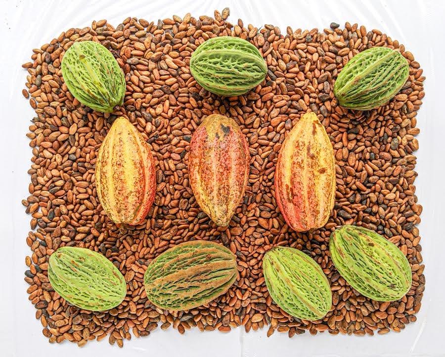
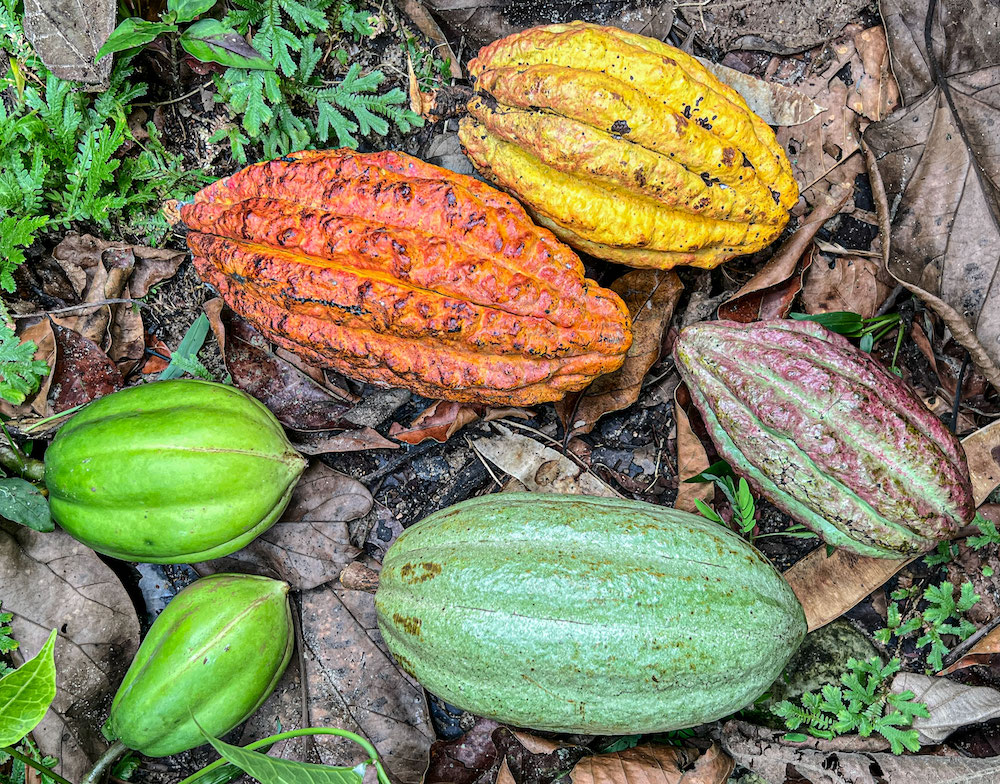
Trees, Beverages, and Maya Cacao Glyphs
Posted August 25, 2025
by Nicholas Hellmuth
 |
 |
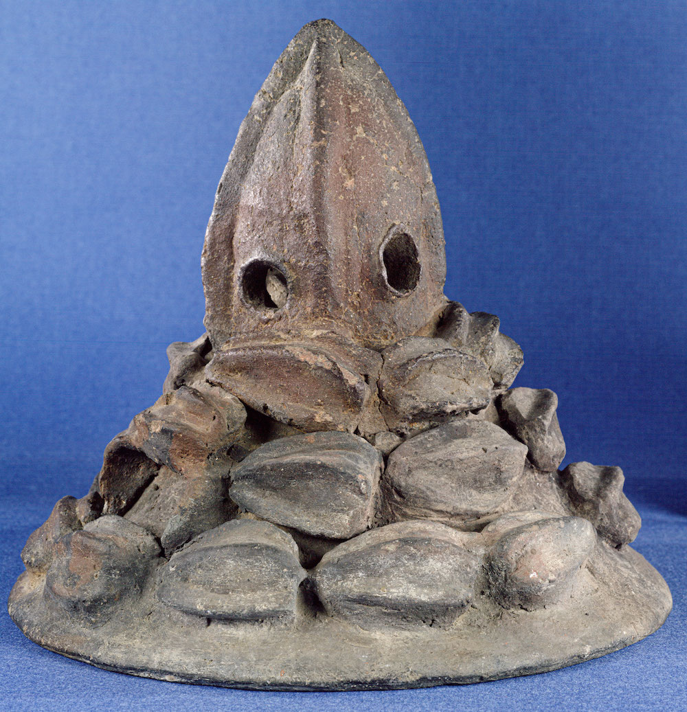 |
We warmly invite you to join us for the Universidad Francisco Marroquin, lecture: Trees, Beverages, and Maya Cacao Glyphs, where we will explore the fascinating world of cacao in ancient Maya culture. Discover the symbolic role of trees, the importance of cacao-based beverages, and the rich legacy preserved in Maya glyphs. This event offers a unique opportunity to connect history, culture, and tradition, while deepening our appreciation of one of the most cherished plants of Mesoamerica.
Thursday, Aug. 28, 2025, 7pm, Museo Popol Vuh, Universidad Francisco Marroquin, lecture Maya Cacao Trees, Maya Cacao Drinks, Maya Cacao Hieroglyphs, And Cacao Pods shown in Classic Maya Art and Tiquisate Style Ceramic Female Portraits Revelation of LOTS of other Native Fruits of Guatemala are same Size and Shape as Cacao Pods.
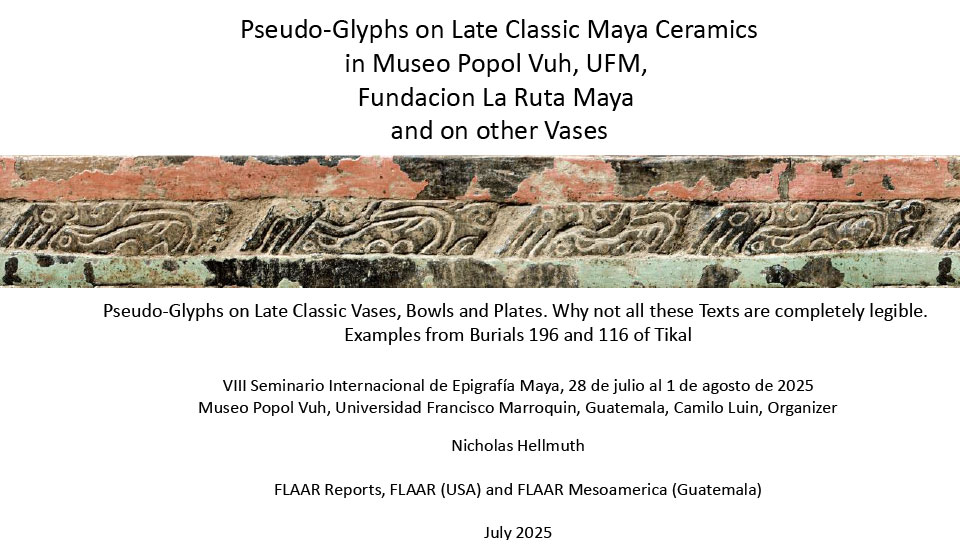
Previously unpublished Late Classic Maya Pseudo-Glyphs now available to study
Posted August 14, 2025
by Nicholas Hellmuth
Inga Calvin has dedicated considerable research and an excellent year 2006 PhD dissertation on Maya pseudo-glyphs. But today in 2025 there are dozens and dozens of additional (previously unpublished) Maya vases, bowls, and plates with pseudo-glyphs, so it is helpful to make all these texts available to epigraphers, linguists, iconographers, and ceramicists. There is now material for a completely new PhD dissertation that can learn from the suggestions in the July 31st epigraphy presentation by Nicholas Hellmuth.
This PDF is the English version of his Spanish presentation (the updated Spanish edition will hopefully be available next week). The present 196-page English edition has over a dozen new photos to add to the extensive corpus in the lecture. We coincide with multiple epigraphers who agree that some of these “pseudo-glyphs” should be studied in depth to learn which types of pseudo-glyphs are actually written to present a message.
VIII Seminario Internacional de Epigrafía Maya, Museo Popol Vuh, Universidad Francisco Marroquin, Guatemala, Camilo Luin, Organizer.
 |
|
Download the 196 pages of photos, information, and bibliography on Maya Pseudo Glyphs. |
Full-Figure Personified Maya Hieroglyphs now available in a Thousand-Page MA thesis
Posted July 1, 2025
by Nicholas Hellmuth
Since I have been studying full-figure Maya hieroglyphs for several years, I was pleasantly surprised to find a 1,064 page opus that is the most comprehensive list (inventory, catalog) of full-figure Maya hieroglyphs ever published.
He shows more full-figure Maya hieroglyphs than Morley, Thompson and all other books “Introductions to Maya Hieroglyphs” combined. I have been preparing lists of full-figure Maya glyphs since 2023 and I estimate that Mauricio Moreno Magariño has found and documented many more that I had not yet found.
If you are an epigrapher, iconographer or archaeologist this thousand-pages of hieroglyphic research is essential. It is the most comprehensive corpus of full-figure glyphs ever amassed—with the majority cited as to source (site and sculpture name), illustrator, and where published.
If you are a student or member of the interested public, and you would like to learn more about Maya hieroglyphs, full-figure glyphs are the easiest way to learn—since each glyph is literally a complete bird, complete jaguar, complete rabbit, etc. So they are not just symbols.
 |
|
With the permission of Mauricio Moreno Magariño we are posting his MA thesis on the FLAAR web site. His drawings are excellent and include the remarkable full-figure hieroglyphs of Yaxchilan Throne 2, one of the most amazing full-figure text other than the many at Copan, Quirigua, Yaxchilan, Palenque and elsewhere.
|
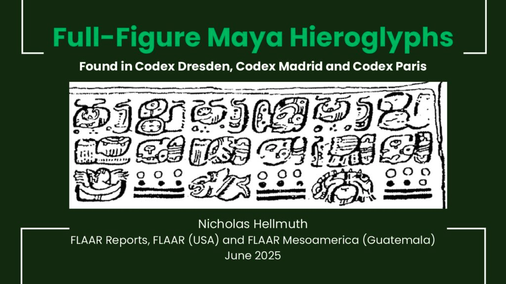
Full-Figure Hieroglyphs in three Maya Codices Codex Dresden, Codex Madrid and Codex Paris
Posted July 1, 2025
by Nicholas Hellmuth
80% of helpful studies of full-figure Maya hieroglyphs have been on stone sculptures (stelae, lintels, altars, wall panels, etc.) and 20% have found and make available full-figure hieroglyphs on artifacts, especially Maya vases and bowls, found usually in burials and cached offerings. I now add to these helpful studies a comprehensive catalog (inventory, list) of 98% of all full-figure hieroglyphs in the three Maya codices. I estimate that there could be another few glyphs that I missed. Mauricio Moreno kindly sent me two images that I added. Any other examples would be welcomed.
 |
|
Full-Figure Maya Hieroglyphs Found in Codex Dresden, Codex Madrid and Codex Paris |
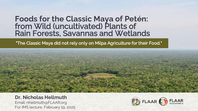
What the Classic Maya actually had available for Food is very different than how Classic Maya Food Sources are presented in Books, Sympsosium Presentations, and Scholarly Articles
Posted February 21, 2025
by Nicholas Hellmuth
 |
|
Complete two-hundred pages of photographs of flowers, fruits, leaves, of vines, trees, palms and LOTS of other wild plants native to the Peten rain forests that were available to the Clas-sic Maya for thousands of years. |
Before the lecture for IMS (Institute for Maya Studies) we showed a preview—now here are the complete 200+ pages of beautiful photos of edible wild plants of savannas of Parque Nacional Yaxha, Nakum, Naranjo and Parque Nacional Laguna del Tigre, Peten.
We show the flowers in addition to the actual plants and fruits, and show the swamps and savannas where we found all these edible wild plants during recent six years of field work in remote areas of the Reserva de la Biosfera Maya, RBM.


If you wish to donate your library on pre-Columbian Mesoamerica and related topics, FLAAR will be glad to receive your library and find a good home for it. Contact:
ReaderService@FLAAR.org
MAYA EPIGRAPHY
Cacao (cocoa) & Flavorings
MAYA AGRICULTURE
Bats
Ancient Maya Rubber Ballgame
Maya Iconography
FLAAR Photo Archives
MAYAN SOCIETIES, ORGANIZATIONS
PNYNN (Yaxha)
CHOLTI-LACANDON
DYE COLORANTS from MAYA PLANTS
FOODS OF THE MAYA ROOT CROPS
Mayan Ethnobotany
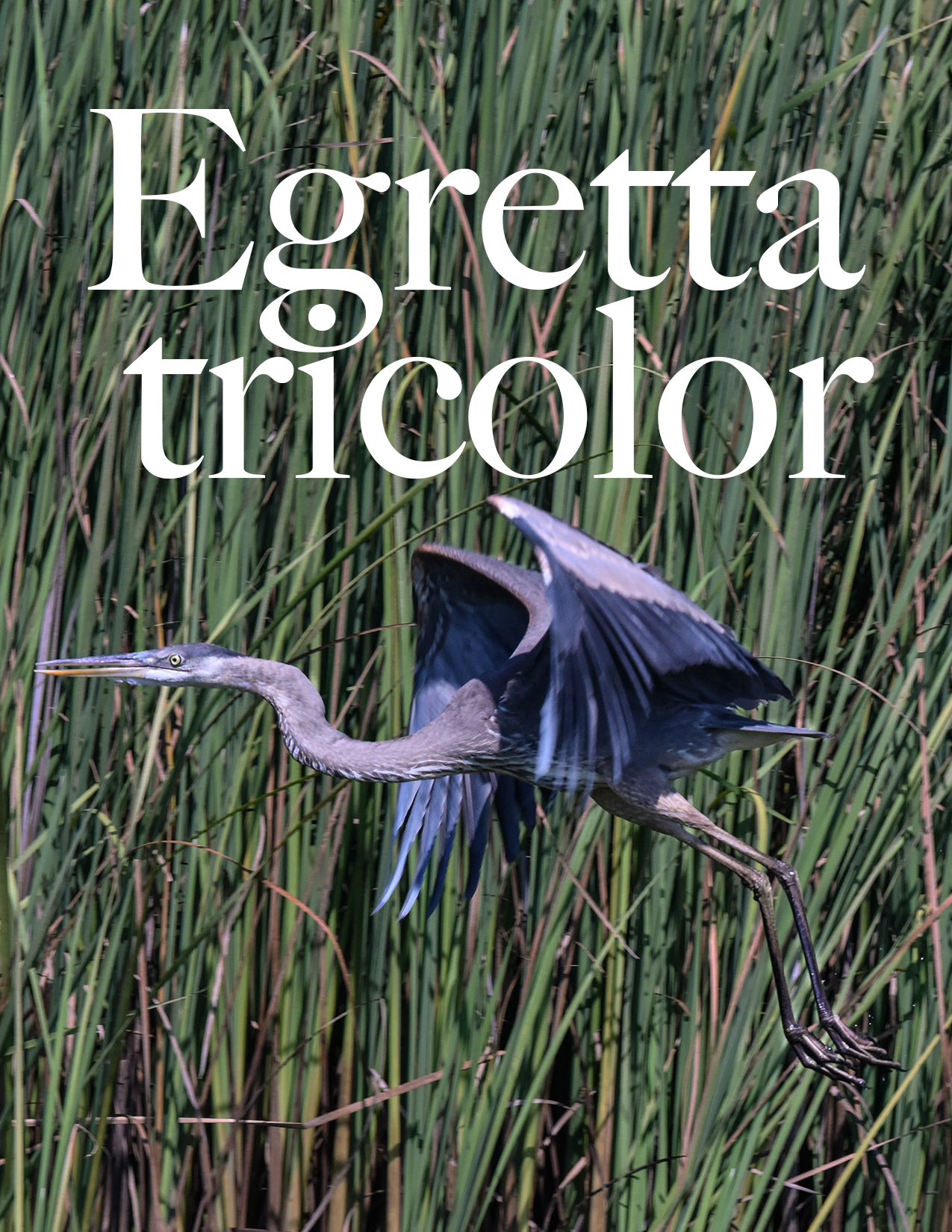
BIRDS in Mayan Archaeology
Maya Ethnozoology
Mayan Linguistics
MAYAN MUSIC
Q’eqchi’-Spanish-English Dictionary Segments
MAYA FOOD, DIET
CAVES of the Maya World
2012 Prophecies of the end Mayan calendar
3D Scanning Equipment Reviews For Field Work
Bibliography Mayan dye colorants
GigaPan Epic Pro System
Municipio de Livingston Izabal: places to visit
TECHNOLOGY for Archaeologists, Anthropologists, Zoologists, Botanists, Geologists
TECHNOLOGY, BOOK REVIEWS on Digital Imaging, especially 3D
Antigua Guatemala
Ixchel
Cotzumalguapa
Popol Vuh
Suchitepequez
Uaxactun
Agriculture, diet, food
Maya Vase Rollouts
Maya Archaeology Sites
FLAAR Mesoamerica
Geology: Minerals & Stones of Mayan areas
Zoological Parks
Parks
Maya Archaeology
Maya Architecture
Maya ethnohistory
Glossary
Trees of Mesoamerica
Mayan languages of Guatemala
Copan
Carlos Pellicer, Tabasco
Textiles
Book Reviews
Education
SYMPOSIUMS Congresses Lectures
DIGITAL CAMERAS for Photographing Research
Lectures on Maya topics Now available
Scanners
Antigua Guatemala
Peten (Tikal, Flores)
Atitlan
Guatemala City
Chichicastenango
Baja Verapaz
Copan Honduras
Archaeology of Iran


Follow us |
||||
Use of this website signifies your agreement to the Terms of Use. Any problem with this site please report it to webmaster@flaar.org, or if you note any error, omission, or have a different opinion on a review, please contact the editor |
||||