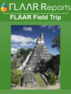
The archaeological site of Yaxhá is considered as a cultural and natural monument. It holds a complex system of wetlands and woods. It’s located in the north part of Guatemala, between the Flores and´ Melchor de Mencos municipalities, in the department of Petén. It limits to the west with the national park of Tikal; at north with the Biological Corridor of Tikal, Mirador and Río Azul; and at south and east, with a multiple use zone.
The site is located over a hill surrounded by the Sacnab and Yaxhá lagoons. It’s inside a zone of two square kilometers, where more than 1700 structures have been identified (Hermes, et al., 1999). The site was inhabited by the Maya civilization since the Preclassic period (1500 B.C. – 250 A.C.), through the Classsic period (250-950 A.C.).
The name of the site was given by the recognition of its emblem glyph, which was phonetically identified by David Stuart. This emblem glyph is distinguish by the sign Yax, symbol that probably represents a psittacid head (maybe of a parrot of macaw). Yaxhá can be read as Yax, that in the Maya language means “blue-green” and ha, that means “water” (Grube & Martin, 2001) (Stuart, 2005).
First investigations
The first registries and publications of Yaxhá were made officially by Teobert Maler, who discovered the site at the beginning of the XX century (specifically in 1905), when he was making several recognitions of the low land zones in the region. Trough this discoveries he could make the first partial map of the site; and during 1958 and 1960, W. Bullard made the first regional analysis of the place.
From 1969 to 1972, Dr. Nicholas Hellmuth made the first excavations of the central area of Yaxhá, and also made the first preliminary map of the site (Hermes, et al., 1999). Between 1980 and 1982, Don and Prudence Rice worked in the area as part of a Historical and Ecological Project of Central Petén. In 1987, the National Project of Tikal made several analysis of the architectural damages of the structures of the site, and in 1988, several activities were made to stabilize the deteriorate areas of several structures (Hermes, et al., 1999).
It is also important to mention the relevance of the nomenclature and the names of some of the paved roads and architectonic groups, which were assigned by the investigations made by Dr. Hellmuth.
One of the characteristics of Yaxhá it’s the urban perspective of the site and a sequence of roads and architectonic complexes with an orientation of a north-south axis. From the lagoon it rises from a sacbé known as the road of the lake, that ends in front of a complex with a structure of astronomical commemoration. The structure measures 180m of length, and where the other road begins its called Blom road of 300m, that ends in the plaza known as Maler group (Hermes, et al., 1999).
Importance of the site
The people that lived in the site had a clear concept of the management and disposal of their living space. In archaeological excavations made in the Maler group, there were found architectural models of the site, carved in limestone rocks, evidence that shows the planning and disposal of the constructions that were made (Valdés, et al, 2008); also, with other evidence, it shows a continual occupational sequence from the Preclassic to the Postclassic period.
The first occupations inside the site were taken place during the Middle Preclassic Period. In the Late Preclassic period, the site experience a considerable growth, and it appears to have been an important peak inside the region. During this period there was an increasing in the constructing activities, also there were found big quantities of ceramic, and other archaeological artifacts, and with its wide distribution, this shows that there was also a population increase (Hermes, et al., 1999).
Around the lagoon, and in the region are several small archaeological sites that were inhabit since the Preclassic period, and were also related in a sociopolitical level with Yaxhá. All the population between the site of Yaxhá and Nakum were eminently rural, dedicated to farming activities, product recollection in the jungle, hunting and fishing (Fialko, 2000).
The main groups of the site are the East Acropolis and North Acropolis, and a complex of type “group E” or astronomic commemoration. Also, in Yaxhá standouts its architectonic characteristics, in which big building complex stand out, among them, are the Twin pyramids or the C Plaza (unique outside the Tikal area). Two ball games; one of them is the biggest one of the Classic period.
Other characteristic of the big Maya cities of the low lands is the construction of big communication roads or paved roads, also known as Sacbé. Until this moment there have been identified ten communication roads, from which four where classified as paved roads and the remaining ones are only routes (Hellmuth, 1973: 45-49).
As mentioned before, several paved roads have been registered in Yaxhá; one of these roads connects with the Central Acropolis and North (Maler). The most important road was the Lake road, because its location is considered as the most useful, as a public entrance from the lagoon to the center of the city. At the beginning of the road is a space that shows a restricted access, which probably was like an economic control center, used during the Late Classic period (Hermes, 1999).
In the Maya Low Lands there are not many water resources, that is why Pre-Hispanic inhabitants have to adapt in order to live in this region. To storage water from the rain and preserved it during the dry seasons they build cavities under the earth carved in limestone rocks, called chultunes. Although Yaxhá is around a lagoon, the inhabitants of the site build several chultunes, but these were not used as cisterns, but as places for private meetings, ceremonies, for storage, and in some occasions as garbage dumpsters (Hermes & Calderón, 2004).
Inside the Main Ceremonial Area (C Plaza), there is a chultun and surrounded in this same area are located several other chultunes in pairs or forming groups. The shape of this chultunes are varied, there are of simple shape and some in an “eight shape” type. Until this time, 27 chultunes have been registered (Heremes & Calderon, 2004).
During the Classic period, the site was used as a religious center and of regional control, maintaining the power of the aquatic rout of the Yaxhá lagoon. During the Late Classic period the city reached its major extension and a considerable population growth. The political, demographic and economic changes contribute to the site’s consolidation as an important center of trade inside the southeast area of Tikal.
In the Terminal Classic the site was inhabited by a system of hierarchy, lead by an elite group that tried to maintain the sociopolitical system that the rulers of the Late Classic period had (Hermes & Martínez, 2004).
During the Postclassic period many great cities in the Maya area showed radical changes, mainly because they stop building big buildings, like the ones they did during the Classic period. During this period, the Maya build lower structures, and more perishable, and almost all the big cities that exited during the Classic period were abandoned (Chase Diane & Arlen, 2004).
It is also of great importance the epigraphic evidence that has been found on the site. According to Grube (2000, quoted from Hermes & Martínez, 2004), at the end of the Late Classic, Yaxhá had a period of independence in which they were able to build some monuments and place them in the center of the city. Stela 13 shows two dates (September 21 of 793 A.D. and August 31 of 797 A.D.), and showed the governor of Yaxhá giving some elements as offerings.
And the text mentioned the name of a governor called K’inich lakantunil. In the other hand, the stela 31 mentions a capture that occur during August 10 of 796 A.D. And stela 35 of Naranjo mentions that during September the 3rd in 799 A.D., the governor of Yaxhá defeated the governor of Naranjo, Itzamnaj K’awiil, but then in stela 12 is another date, May 22 of 800 A.D., were the governor of Yaxhá paid tribute to the governor of Naranjo. This shows that something occur that made Yaxhá a subaltern of Naranjo (Hermes & Martínez, 2004).
 |
|
Anthropomorphic graffiti Drawing: J. Guzmán C.
|
Graffiti in Yaxhá
In several Maya sites are recorded several graffiti drawings in big temples in the ceremonial centers (Tikal, Nakum, Río Azul, etc.). In Yaxhá there have been registered several graffiti in Structure 216, and Structure 375; this are very complex by their diverse anthropomorphic representations, and other complex forms that are hard to define.
The term graffiti is employed in painted and graphitized representations, which are located specifically in walls and floors. There are some explanations about the function or meaning of the graffiti; according to Tozzer (quoted by Guzmán Cazali, 2008), explains that these are testimony of Pre-Hispanic visitors from Maya cities. Other theory is exposed by Kampen who uses several examples from Tikal, in which he said that the graffiti are the effect of profanation of Preclassic buildings, as in the Classic buildings when this were already had lost their function of palaces and temples, and were abandoned by their original inhabits. All this postures are very interesting, although as Guzmán Cazali (2008) mentions, several of this postures were discarded.
The term graffiti is employed in painted and graphitized representations, which are located specifically in walls and floors. There are some explanations about the function or meaning of the graffiti; according to Tozzer (quoted by Guzmán Cazali, 2008), explains that these are testimony of Pre-Hispanic visitors from Maya cities. Other theory is exposed by Kampen who uses several examples from Tikal, in which he said that the graffiti are the effect of profanation of Preclassic buildings, as in the Classic buildings when this were already had lost their function of palaces and temples, and were abandoned by their original inhabits. All this postures are very interesting, although as Guzmán Cazali (2008) mentions, several of this postures were discarded.
 |
|
Procession in recint 1, in the southeast wall. South acropolis, Structure 375, Yaxhá. Photography and drawing: J. Guzmán Cazali (2008). |
|
To view the QTVR click on the image and move the mouse.
|
|
QTVR of Yaxha Archaeological Site, Peten, Guatemala. |
References
- 2000
- Resultados preliminares de las investigaciones realizadas en el Grupo Maler, Yaxha, Petén. In XIII Simposio de Investigaciones Arqueológicas en Guatemala, 1999 (edited by J.P. Laporte, H. Escobedo, B. Arroyo & A.C. de Suasnávar), pp.354-373. Museo Nacional de Arqueología y Etnología, Guatemala (digital version).
- 2001
- Los Mayas del Posclásico, in Maya amaq'. Published by Fundación Cholsamaj,
- 2000
- Distribución de los asentamientos Preclásicos Mayas entre Tikal, Nakum, Yaxha y Naranjo”. In XIII Simposio de Investigaciones Arqueológicas en Guatemala, 1999 (edited by J.P. Laporte, H. Escobedo, B. Arroyo & A.C. de Suasnávar), pp.501-513. Museo Nacional de Arqueología y Etnología, Guatemala (digital version).
- 2006
- Ciudades Sagradas Mayas. Sacred Maya Cities, Petén, Guatemala. Editores López Bruni.
- 2001
- The Coming of Kings: Writing and Dynastic Kingship in the Maya Area Between the Late Preclassic and the Early Classic. Notebook for the XXVth Maya Hieroglyphic Forum at Texas. Maya Workshop Foundation, Austin.
- 2008
- Registro in situ de graffittis prehispánicos, Edificio 375 de la Acrópolis Sur. Yaxha, Informe de Práctica de Campo, Area de Arqueología, Escuela de Historia, Universidad de San Carlos de Guatemala, Guatemala.
- 1993
- A Report for IDAEH on Research Accomplished at the Maya Ruins of Yaxha, Petén, Guatemala. Foundation for Latin American Anthropological Research, Florida.
- 1999
- Investigación arqueológica en Yaxha, Petén: La Calzada del Laguna y la Vía 5. In XII Simposio de Investigaciones Arqueológicas en Guatemala, 1998 (edited by J.P. Laporte & H.L. Escobedo), pp.110-138. Museo Nacional de Arqueología y Etnología, Guatemala.
- 2004
- Chultunes en los alrededores de la Laguna Yaxha Petén. In XVI Simposio de Investigaciones Arqueológicas en Guatemala, 1998 (editado por J.P. Laporte & H.L. Escobedo), Museo Nacional de Arqueología y Etnología, Guatemala.
- 2004
- The Terminal Classic in the Area of the Yaxha Lagoon, Petén. In XVI Simposio de Investigaciones Arqueológicas en Guatemala, 2004 (editado por J.P. Laporte & H.L. Escobedo), Museo Nacional de Arqueología y Etnología, Guatemala.
- 2005
- The Yaxha emblema glyph as Yax-ha. Research Reports on Ancient Maya Writing 1. Washington, D.C. Center for Maya Research. Electronic Edition from the original Edition, published in 1985. www.mesoweb.com/bearc/cmr/RRAMW01.pdf
2008 Los graffitis prehispánicos de Yaxhá. Arqueología. Web Page: http://graffitisyaxha.blogspot.com/
Updated April 14, 2010.
First Posted Jan 2007.